South Pacific
Pérez Zeledon / San Isidro de El General
The canton of Pérez Zeledón is located in the Brunca region south of the country´s highest mountain pass, the Cerro de la Muerte. The capital city of the canton is San Isidro de El General. Situated in the foothills of the Talamanca Mountains and mainly agricultural, the valley of San Isidro offers amazing views of the surrounding landscapes. Around 20 km east of San Isidro de El General, at an altitude of 1´350 meters above sea level, the small village San Gerardo de Rivas is located. This peaceful place with around 400 inhabitants is surrounded by the highest mountains of the country and offers spectacular views of the Talamanca Mountain Range.
LOAD MORE...A paradise for nature lovers, hikers, birdwatchers and photographers. The magical surroundings provide space for lots of activities, such as hot pools, hiking in nature reserves, coffee plantations, bird watching tours, and, not to forget, the Chirripó National Park, with its height of 3´820m the highest mountain in the country and one of the highest in whole Central America. Everything grows in this impressive region and you can admire beautiful plants, expect interesting wildlife sightings and encounter birds of every size and colour, with a little bit of luck you may even spot the famous Resplendent Quetzal. The rural atmosphere and its friendly people make visitors feel more than welcome and give them the opportunity to experience authentic Tico-style living and the real Costa Rica. San Isidro de El General is also the gateway to several other national parks such as Los Quetzales, Marino Ballena or Corcovado, each one being completely different from the other and, therefore, providing the chance to explore different microclimates, landscapes, and forests.
Dominical / Uvita
The small town Dominical on the Pacific Coast hasn’t yet been discovered by the tourism industry - all the better for you! It is located around 40 km south of Quepos, and a few restaurants and bars make up the village. Enjoy the peace and mingle with the town’s inhabitants, mostly surf freaks and escapists who’ve fallen in love with the wild and secluded beaches of the Southern Pacific Coast. About 17 km south of Dominical, we find the small village of Uvita, really nothing more than a handful of houses and some shops.
LOAD MORE...Uvita is an excellent base for visits to Marino Ballena National Park, protecting more than 5´500 hectares of beach, mangrove estuary, rainforest and primarily marine habitats. It got especially famous as an important calving area of the humpback whales. Whales from the North arrive from approximately December to April, while animals from the South may be seen from approximately July to November (no guarantees).
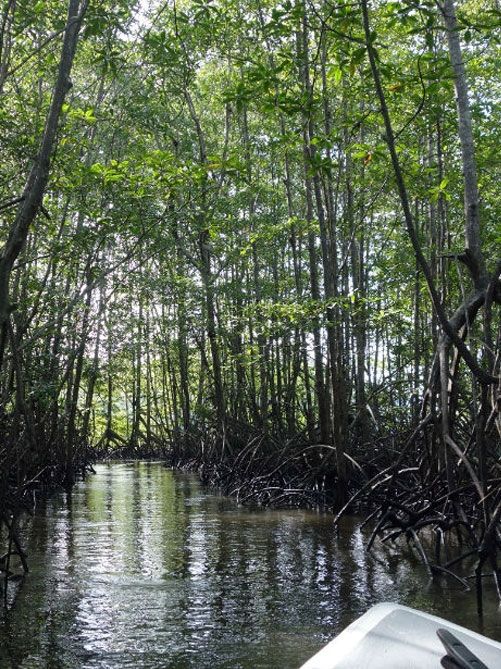
For travellers with a rental car, Dominical and Uvita are great starting points for excursions to the beaches nearby and further south. Just like the rest of the Pacific shore, the beaches here have a strong surf to watch out for. They are usually long wild stretches of beautiful sand strewn with driftwood. Travellers in search of a secluded abode in the middle of untouched nature will feel right at home here. Various excursions, bookable in the hotels, are offered in the region (among many others): Horseback riding tours to an idyllic waterfall, jungle hikes, kayak tours on the ocean or through roaming mangrove forests, as well as dolphin and whale watching around the Marino Ballena National Park. Dominical and Uvita are reached via the highest mountain passage in Costa Rica, the Cerro de la Muerte (3´400m) and San Isidro de El General, or via the comfortable coastal road Quepos - Dominical.
Osa / Puerto Jimenez / Golfito
The Osa Peninsula in the Southwestern part of the country is one of the most interesting regions of Costa Rica. Almost the whole peninsula is covered by rainforest, protected by the Corcovado National Park. Thanks to the difficult access, it’s home to many species which elsewhere in Central America are in serious danger of extinction or have already become extinct. Over millions of years, this ecosystem also has developed some endemic species of plants and animals.
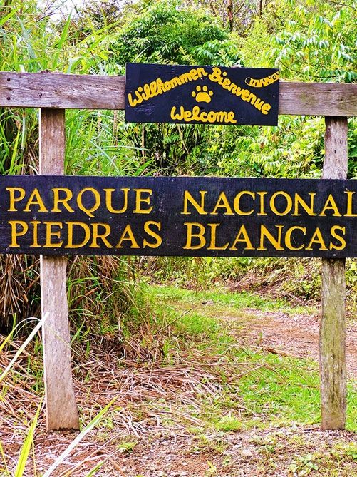
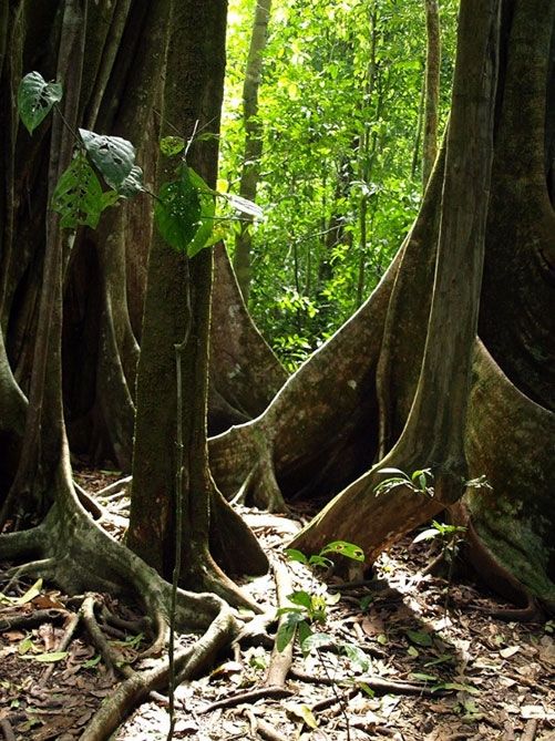
LOAD MORE...Visitors can observe the incredible biodiversity at close range from the few but well-maintained paths throughout the Park. However, you need to be very lucky to observe big animals like tapirs, jaguars or crocodiles. Within just 1 hectare of land, you may find over 100 species of trees, some of them with a height of more than 60 meters. They are the natural habitat of plenty of bromeliads and orchids. Heat and humidity are part of this habitat and therefore also of your perfect jungle adventure. Caño Island National Park is located in front of the peninsula. Tours to the island are among the most popular activities offered in the region, as, thanks to its protected reefs, it offers excellent snorkelling and diving possibilities. Walks on the island are not permitted anymore, but from your tour guide, you will learn some interesting facts about this ancient pirate hiding place. The village of Puerto Jiménez is located directly on the shores of the Golfo Dulce. A nice beach to relax in case you´re spending a night here forms part of the village. Before Corcovado National Park was created, Puerto Jiménez held a key position in gold mining and logging. Nowadays, it is the gateway to Corcovado National Park from the southeast. It is the last village before entering the park, and most people make a stop here to provide themselves with all necessary for the following days. Apart from Corcovado National Park, different excursions in the surroundings are offered, such as hiking tours, rappelling, biking, kayaking, or dolphin observation tours in the beautiful Golfo Dulce. The small port town of Golfito is located in the Golfo Dulce, nearly opposite to Puerto Jiménez. It is protected by the Golfito Bay and surrounded by steep green hills covered with tropical rain forest. In former times, Golfito was the main port on the South Pacific coast exporting the bananas produced in the huge banana plantations around. When banana infecting diseases and massive worker strikes affected the production, the banana companies left the area. The Costa Rican government later established a duty-free zone in Golfito, in order to improve the hard economic situation of the region. Several nice tours are offered in the area, such as dolphin watching, hiking to Golfito National Wildlife Refuge with stunning views of the bay and the Golfo Dulce, mangrove tours, hiking tours to beautiful waterfalls nearby, boat rides to a nearby Orchid Garden and much more. The beautiful beach Playa Zancudo, as well as the well-known surfing spot Pavones south of Golfito, can be reached in about 1 hour by car. In the North of Golfito, we find Piedras Blancas National Park, protecting over 14´000ha of primary forest shaped by Esquinas and Piedras Blancas Rivers, untouched beaches, and nice waterfalls. Some of the lodges we offer are located close to or inside the park.
Piedras Blancas National Park is home to several species of felines, such as the ocelot, margay, jaguarundi, and the rare puma and jaguar. A large number of bird species, mammals, reptiles and frogs can be encountered here, among them scarlet macaws, toucans, kinkajous, coatis, white-faced capuchin and spider monkeys, two-toed sloths, and anteaters, as well as over 50 species of bats. Just off the coast impressing coral reefs provide excellent places to snorkel and swim. The best way to reach Osa peninsula and Golfito is by plane to Drake Bay, Puerto Jiménez, or Golfito. At Drake Bay and Golfito airstrips, you will be picked up by a representative of your hotel. From Puerto Jiménez, you access the Southern part of the peninsula and reach the southern entrance of Corcovado National Park by an adventurous 4x4 taxi transfer to Carate, passing by pasture land, forests, and crossing a few rivers. From Carate, it takes an another 3km walk along the beach to the ranger station of La Leona. From here, finally, you get immersed into the magical and almost untouched world of pure nature many other people may only dream of.
San Vito
San Vito de Coto Brus is one of the most multicultural places throughout Costa Rica. Indigenous ethnic groups, Costa Rican farmers and Italian immigrants live here together in a fascinating, varied natural environment. It is no coincidence that so many different cultures have chosen to live in this region – its idyllic atmosphere and breathtaking landscapes simply make it the ideal home. San Vito de Coto Brus has a moderate climate and is surrounded by several different mountain ranges. It is the ideal starting point for a variety of cultural activities and offers excellent bird watching. Costa Rica's largest protected forest region, the La Amistad International Park, is close-by; it stretches out over both neighbouring countries Costa Rica and Panama and represents the living proof of the joined efforts for wildlife conservation.
San Isidro del General
In San Isidro Del General, tourists are not a common sight, but definitely given a warm welcome. Visitors are treated as friends by the natives who gladly introduce them to their beautiful region. San Isidro offers the perfect combination of urban and rural atmosphere. The region is mainly characterised by agriculture, but its inhabitants also enjoy being close to both the Costa Rican capital and the beautiful beaches of the South Pacific. Tourists also like the diversity of this interesting region, which, due to its altitude and especially the low temperatures that travellers of the past had to endure on their way from Southern Costa Rica to the Central Valley, is known as Cerro de la Muerte (“Mountain of Death”). This is a great starting point to a variety of attractive destinations, like the Cerro Chirripó for hiking or one of the gorgeous nearby beaches.


